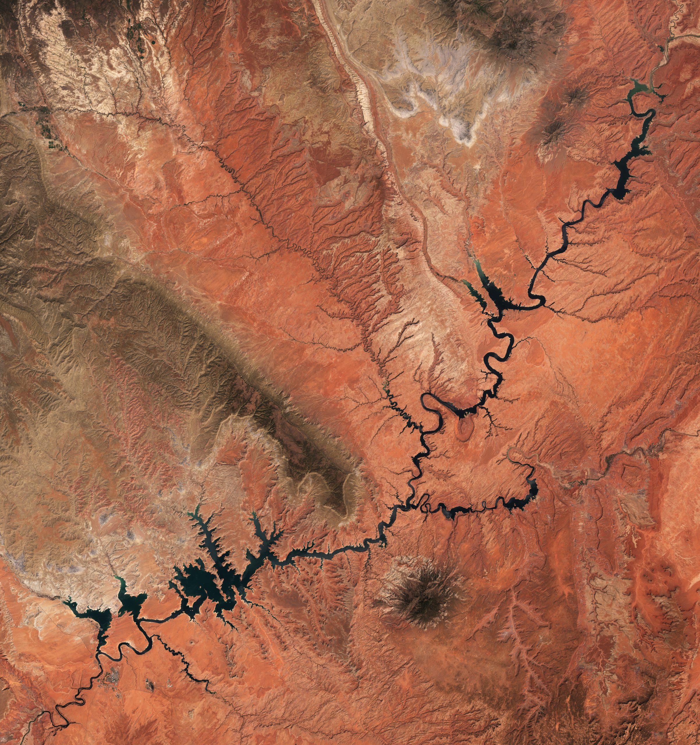
The milestone is more than a striking shoreline marker. It puts Lake Powell closer to a level where Glen Canyon Dam cannot generate electricity and intensifies pressure on seven Western states to reduce water use.
Lake Powell, the second-largest reservoir in the United States, fell to its lowest water level on record Saturday: 3,519.91 feet. The Colorado River reservoir, which provides water and electricity to millions of people in the American West, slipped below its prior record of 3,519.92 feet set in April 2023, according to U.S. Bureau of Reclamation data.
The new low is a warning for a river system already under extraordinary strain. Lake Powell is now less than 30 feet above the elevation at which Glen Canyon Dam can no longer generate hydropower, raising the stakes for water managers, cities, farms, Tribes and states dependent on the Colorado River.
A record measured in inches
A change of one-hundredth of a foot may sound trivial, but the significance is historical. Lake Powell took 17 years to fill after Glen Canyon Dam began impounding the Colorado River in 1963; it once reached a full-pool elevation of 3,700 feet.
Reservoir levels normally rise with Rocky Mountain snowmelt from roughly May through July, then recede through the rest of the year. That seasonal cycle has always left visible mineral “bathtub rings” along Lake Powell’s canyon walls. The concern now is not ordinary seasonal movement, but a long decline made worse by a warm, dry winter and years of depleted runoff.
Jack Schmidt, director of the Center for Colorado River Studies at Utah State University, described the situation as “uncharted territory.” The record at Powell came only nine days after Lake Mead, the nation’s largest reservoir, reached its lowest level since it was filled about nine decades ago.
Powell and Mead function together
Lake Powell and Lake Mead are separated by the Grand Canyon, but in water-management terms they operate like linked savings accounts for the Colorado River Basin. Together, they hold just under 60% of the water currently stored in the basin, according to the reporting.
That makes the simultaneous decline especially consequential. The Colorado River supplies roughly 40 million people and irrigates more than 5 million acres of farmland across California, Arizona, Nevada, New Mexico, Wyoming, Colorado and Utah before reaching Mexico.
The river’s shrinkage reflects overlapping pressures rather than one bad season alone. Climate change-driven warming, prolonged drought and heavy water use have cut the Colorado River’s flow by roughly 20% since 2000, according to the source reporting. Warmer winters also mean that less mountain snow is available and that more water can be lost before runoff reaches major reservoirs.
The hydropower threshold is approaching
The immediate physical benchmark at Lake Powell is known as minimum power pool, an elevation of 3,490 feet. Below that point, water would be too low to reliably turn the eight turbines at Glen Canyon Dam.
Those turbines generate enough electricity in a typical year to power nearly 500,000 households. The power is used across Colorado, Utah, Wyoming, New Mexico, Arizona, Nevada and Nebraska, so the consequences of lower water extend beyond communities directly beside the river.
Brad Udall, a senior water and climate research scientist at Colorado State University, said the threshold could be reached this year without “extraordinary measures,” including reduced releases from Lake Powell and reservoirs upstream. That is not a prediction that household lights will suddenly go out; it is a sign that the system’s operating flexibility is becoming more limited.
An even more severe benchmark, called deadpool, sits below 3,370 feet. At that elevation, water could no longer flow downstream through Glen Canyon Dam. Experts cited in the reporting do not present that outcome as inevitable, but its existence explains why officials are focused on preventing the decline from getting close.
Water cuts now carry sharper stakes
The seven states that share Colorado River water have spent years negotiating how to divide less water. Those talks did not produce a final agreement, and federal authorities are expected to set required reductions through 2028.
Lake Powell’s record low changes the backdrop for those decisions. Reducing releases can help retain water upstream and protect power generation, but every withheld release can tighten supplies for users farther downriver. The central policy challenge is not whether cuts will be painful; it is how to spread them while preserving essential water deliveries and critical infrastructure.
The U.S. Bureau of Reclamation said it and the Department of the Interior remain committed to reducing the risk that Lake Powell and Lake Mead fall below critical elevations. That language reflects the difficult balance ahead: protect the reservoirs while meeting water and hydropower needs across the basin.
Not every community has equal options
There is an important distinction between a stressed river system and an immediate loss of drinking water. Water-policy experts told CNN that they do not currently expect taps across the Southwest simply to run dry. Major cities have spent years preparing for shortages and securing backup supplies.
Phoenix and Tucson, for example, know they could face early reductions and have invested in contingency planning. Larger cities can often finance conservation programs, groundwater management, water banking or alternative supplies.
That capacity is not evenly shared. Sarah Porter, director of Arizona State University’s Kyl Center for Water Policy, said Tribes and smaller Colorado River communities may find costly alternatives much less feasible. That equity gap is likely to be central as cuts are assigned: the same shortage can be far easier for a large municipality to absorb than for a rural or under-resourced community.
A wet winter would help, not solve it
El Niño conditions can bring more rain and snow to parts of the Southwest, offering a possible short-term lift to reservoir inflows. But a single wet winter cannot erase a water deficit that has accumulated over more than two decades.
Lake Powell’s record level is therefore a marker of a bigger transition. The West is being forced to plan around a Colorado River that may deliver less water than the infrastructure, farms and cities built around it were designed to expect.
The crucial question is whether states and federal agencies can make durable reductions before reservoir levels force more drastic action. For now, the new record at Lake Powell is a precise number with broad meaning: the margin between routine management and emergency choices has narrowed again.
Leave a Reply